
|
|
Belgrade

Knez Mihailova Street - The main pedestrian and shopping zone in Belgrade. Author: George Maris
Belgrade is the capital and largest city of Serbia. It is located at the confluence of the Sava and Danube rivers and the crossroads of the Pannonian Plain and the Balkan Peninsula. Nearly 1.7 million people live within the administrative limits of the City of Belgrade.
Belgrade is one of the oldest continuously inhabited cities in Europe and the World. One of the most important prehistoric cultures of Europe, the Vinča culture, evolved within the Belgrade area in the 6th millennium BC. In antiquity, Thraco-Dacians inhabited the region and, after 279 BC, Celts settled the city, naming it Singidūn. It was conquered by the Romans under the reign of Augustus and awarded Roman city rights in the mid-2nd century. It was settled by the Slavs in the 520s, and changed hands several times between the Byzantine Empire, the Frankish Empire, the Bulgarian Empire, and the Kingdom of Hungary before it became the seat of the Serbian king Stefan Dragutin in 1284. Belgrade served as capital of the Serbian Despotate during the reign of Stefan Lazarević, and then his successor Đurađ Branković returned it to the Hungarian king in 1427. Read more.... Belgrade - Wikipedia Knez Mihailova Street - Wikipedia Skadarlija - Wikipedia |
These instructions are for intended purposes only. You may find that conditions differ from the map results due to construction, traffic, old conditions or other events, so you should plan your route accordingly. You must obey any signs or warnings that concern your route.
How to get there ?
Places to visit in BelgradeClick on any point of interest for directions on how to get there.
|


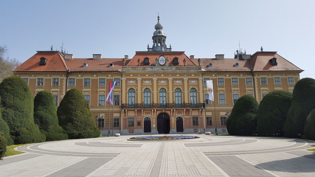
Subotica

Subotica Town Hall , Author Julian Nyča
Subotica (Serbian Cyrillic: Суботица, pronounced [sǔbotitsa] Hungarian: Szabadka) is a city and the administrative center of the North Bačka District in the autonomous province of Vojvodina, Serbia. Formerly the largest city of Vojvodina region, contemporary Subotica is now the second largest city in the province, following the city of Novi Sad. It is located in the Pannonian Basin, about 10 kilometres (6 miles) from the border with Hungary, and is the northernmost city in Serbia. It is located in the vicinity of lake Palić.
Read more….. Subotica - Wikipedia *Soon we will have new photos
|
The distance from Belgrade is about 188 km. Approximate time 1h:59m by car.
These instructions are for intended purposes only. You may find that conditions differ from the map results due to construction, traffic, old conditions or other events, so you should plan your route accordingly. You must obey any signs or warnings that concern your route. How to get there ?
Places to visit in SuboticaClick on any point of interest for directions on how to get there.
|


Sombor
Author: Vkuncak - Sombor Županija building housing city administration today
Sombor (Serbian Cyrillic: Сомбор, pronounced [sɔ̂mbɔr]; Hungarian: Zombor; Rusyn: Зомбор, romanized: Zombor) is a city and the administrative center of the West Bačka District in the autonomous province of Vojvodina, Serbia. The city has a total population of 41,814 (as of 2022), while its administrative area (including neighboring villages) has 70,818 inhabitants.
In Serbian, the city is known as Sombor (Сомбор), in Hungarian as Zombor, in Rusyn as Zombor (Зомбор). The older Hungarian name for the city was Czoborszentmihály. The name originates from the Czobor family, who were the owners of this area in the 14th century. (The family name came from the Slavic name Cibor.) The Serbian name for the city (Sombor) also came from the family name Czobor, and was first recorded in 1543, although the city was mentioned in historical documents under several more names, such as Samobor, Sambor, Sambir, Sonbor, Sanbur, Zibor, and Zombar. An unofficial name for the city is Ravangrad (Раванград), which literally means "flat town" in Serbian. Read more…… Sombor - Wikipedia *Soon we will have new photos
|
The distance from Belgrade is about 182 km. Approximate time 2h:8m by car.
These instructions are for intended purposes only. You may find that conditions differ from the map results due to construction, traffic, old conditions or other events, so you should plan your route accordingly. You must obey any signs or warnings that concern your route. How to get there ?
Places to visit in Sombor
For bus or train tickets
|
Novi Sad

Petrovaradin and the victims of the raid, Author: Pokrajac
Novi Sad (Serbian Cyrillic: Нови Сад, ) is the second largest city in Serbia and the capital of the autonomous province of Vojvodina. It is located in the southern portion of the Pannonian Plain on the border of the Bačka and Syrmia geographical regions. Lying on the banks of the Danube river, the city faces the northern slopes of Fruška Gora.
According to the 2011 census, Novi Sad proper has a population of 250,439 while its urban area (including the adjacent settlements of Petrovaradin and Sremska Kamenica) comprises 277,522 inhabitants. The population of the administrative area of the city totals 341,625 people. Novi Sad was founded in 1694 when Serb merchants formed a colony across the Danube from the Petrovaradin Fortress, a strategic Habsburg military post. In subsequent centuries, it became an important trading, manufacturing and cultural centre, and has historically been dubbed the Serbian Athens. The city was heavily devastated in the 1848 Revolution, but was subsequently rebuilt and restored. Today, along with the Serbian capital city of Belgrade, Novi Sad is an industrial and financial center important to the Serbian economy. Novi Sad is the European Capital of Culture for the year 2022 and European Youth Capital 2019. Read more.... Novi Sad - Wikipedia *Soon we will have new photos
|
The distance from Belgrade is about 97,1 km. Approximate time 1h:18m by car.
These instructions are for intended purposes only. You may find that conditions differ from the map results due to construction, traffic, old conditions or other events, so you should plan your route accordingly. You must obey any signs or warnings that concern your route. How to get there ?
Places to visit in Novi SadClick on any point of interest for directions on how to get there.
|


Sremski Karlovci

RS-NS-SK-Karlóca, Author Szeder László
Sremski Karlovci (Serbian Cyrillic: Сремски Карловци, pronounced [srêːmskiː kâːrloːʋt͡si]; Hungarian: Karlóca) is a town and municipality located in the South Bačka District of the autonomous province of Vojvodina, Serbia. It is situated on the banks of the Danube, 8 kilometres (5 miles) from Novi Sad.
The town is situated along the Danube River in the geographical region of Syrmia. The town of Sremski Karlovci is the only settlement in the municipality.In ancient times, the Romans maintained a small fortress at this location. The town was first mentioned in historical documents in 1308 with the name Karom. The medieval fortress of Karom was built on the ruins of the ancient Roman one. Until 1521, Karom was a possession of Hungarian noble families, of whom the most well known were Báthory and Morović. In 1521, Turkish military commander Bali-beg conquered Karom under the Ottoman Empire's invasion of Europe. During the next 170 years, the town was part of the Ottoman Empire. The Slavic name for the town - Karlovci, was first recorded in 1532/33. During Ottoman rule, the town was still predominately Serbian in ethnicity, with the smaller part of population composed of Muslims. According to the Ottoman defterler from 1545,[citation needed] the population of Karlovci numbered 547 Christian(Serb) houses. The city also had three Orthodox churches and a monastery. From 1557, it belonged to Eparchy of Belgrade and Srem of the Serbian Patriarchate of Peć. Read more….. Sremski Karlovci - Wikipedia *Soon we will have new photos
|
The distance from Belgrade is about 79 km. Approximate time 56m by car.
These instructions are for intended purposes only. You may find that conditions differ from the map results due to construction, traffic, old conditions or other events, so you should plan your route accordingly. You must obey any signs or warnings that concern your route. How to get there ?
Places to visit in Sremski KarlovciClick on any point of interest for directions on how to get there.

For bus or train tickets
|
Zrenjanin

Gradska kuća (Town house) , Author: George Maris
Zrenjanin (Serbian Cyrillic: Зрењанин, pronounced [zrɛ̌ɲanin]; Hungarian: Nagybecskerek; Slovak: Zrenjanin; German: Großbetschkerek) is a city and the administrative center of the Central Banat District in the autonomous province of Vojvodina, Serbia. The city urban area has a population of 76,511 inhabitants, while the city administrative area has 123,362 inhabitants (2011 census data).
Zrenjanin is the largest city in the Serbian part of the Banat geographical region, and the third largest city in Vojvodina (after Novi Sad and Subotica). The city was designated European city of sport. Read more.... Zrenjanin - Wikipedia |
The distance from Belgrade is about 82,4 km. Approximate time 1h:11m by car.
These instructions are for intended purposes only. You may find that conditions differ from the map results due to construction, traffic, old conditions or other events, so you should plan your route accordingly. You must obey any signs or warnings that concern your route. How to get there ?
A big thank you to our friend Dusko (Professional tour guide) for the tour he gave us in his beautiful city and for his photos.
Places to visit in ZrenjaninClick on any point of interest for directions on how to get there.

Use Moovit for the local trasportation
|
Vrsac

Vršac, Author: Jorge Láscar
Vršac (Serbian Cyrillic: Вршац, Hungarian: Versec; Romanian: Vârșeț) is a city and the administrative centre of the South Banat District in the autonomous province of Vojvodina, Serbia. As of 2011, the city urban area had a population of 35,701, while the city administrative area had 52,026 inhabitants. It is located in the geographical region of Banat. The name Vršac is of Serbian origin, ultimately deriving from Proto-Slavic *vьrxъ, meaning "summit". In Serbian, the city is known as Вршац or Vršac, in Romanian as Vârșeț, in Hungarian as Versec or Versecz, in German as Werschetz, and in Turkish as Virşac or Verşe.
Read more…. Vršac - Wikipedia *Soon we will have new photos
|
The distance from Belgrade is about 90,8 km. Approximate time 1h:31m by car.
These instructions are for intended purposes only. You may find that conditions differ from the map results due to construction, traffic, old conditions or other events, so you should plan your route accordingly. You must obey any signs or warnings that concern your route. Places to visit in VršacClick on any point of interest for directions on how to get there.
|
Smederevo

Smederevo city administration, Author:Cornelius Bechtler
Smederevo (Serbian Cyrillic: Смедерево, pronounced [smêdereʋo];
Hungarian: Szendrő) is a city and the administrative center of the Podunavlje District in eastern Serbia. It is situated on the right bank of the Danube, about 45 kilometres (28 miles) downstream of the Serbian capital, Belgrade. According to the 2011 census, the city has a population of 64,105, with 108,209 people living in its administrative area. Its history starts in the 1st century BC, after the conquest of the Roman Empire, when there existed a settlement by the name of Vinceia. The modern city traces its roots back to the Late Middle Ages when it was the capital (1430–39, and 1444–59) of the last independent Serbian state before Ottoman conquest. Smederevo is said to be the city of iron (Serbian: гвожђе / gvožđe) and grapes(грожђе / grožđe). Read more…. Smederevo - Wikipedia |
The distance from Belgrade is about 62,3 km. Approximate time 53m by car.
These instructions are for intended purposes only. You may find that conditions differ from the map results due to construction, traffic, old conditions or other events, so you should plan your route accordingly. You must obey any signs or warnings that concern your route. How to get there ?
Places to visit in SmederevoClick on any point of interest for directions on how to get there.

Use Omio for bus or train tickets
|
Kostolac - Viminacium

Viminatium, Author:Neva Micheva
The City municipality of Kostolac (Serbian Cyrillic: Градска општина Костолац, romanized: Gradska opština Kostolac is a town in Serbia and one of two city municipalities which constitute the City of Požarevac. It is situated on the Danube river. The remains of the Roman capital of the province of Moesia Superior Viminacium are located near Stari Kostolac some 2 km to the east of Kostolac. Kostolac is also a center of area called Stig and home of thermal power plants and coal mines.
Viminacium (Viminacium) or Viminatium, was a major city (provincial capital) and military camp of the Roman province of Moesia (today's Serbia), and the capital of Moesia Superior (hence once a metropolitan archbishopric, now a Latin titular see). As of 2018, only 3-4% of the site has been explored. The site is located 12 km (7.5 mi) from the modern town of Kostolac in Eastern Serbia. The city dates back to the 1st century AD, and at its peak it is believed to have had 40,000 inhabitants, making it one of the biggest cities in the Balkans of that time. It lies on the Roman road Via Militaris. Viminacium was devastated by Hunsin the 5th century, but was later rebuilt by Justinian. It was completely destroyed with the arrival of Slavs in the 6th century. Today, the archaeological site occupies a total of 450 hectares (1,100 acres), and contains remains of temples, streets, squares, amphitheatres, palaces, hippodromes and Roman baths. Viminacium holds the distinction of having the largest number of graves discovered in any Roman archaeological site. As of 2018, 15,000 graves have been discovered. Kostalac - Wikipedia Viminacium - Wikipedia *Soon we will have new photos
|
The distance from Belgrade is about 88,3 klm. Approximate time 1h:4m by car.
These instructions are for intended purposes only. You may find that conditions differ from the map results due to construction, traffic, old conditions or other events, so you should plan your route accordingly. You must obey any signs or warnings that concern your route. How to get there ?
Places to visit in KostolacClick on any point of interest for directions on how to get there.

Use Omio for bus or train tickets
|
Donji Milanovac
|
Donji Milanovac (Serbian Cyrillic: Доњи Милановац, pronounced [dɔ̂ːɲiː mǐlanɔvats]) is a town in eastern Serbia. It is situated in the Majdanpekmunicipality, in the Bor District. It is located on the right bank of Lake Đerdap on the Danube. The population of the town is 2,410 people (2011 census). Its name means "Lower Milanovac" (there is an Upper Milanovac, as well). The management office of Đerdap national park is located in the town.It has been nicknamed a "town of 100,000 roses".[ The town is located on the right bank of Lake Đerdap on the Danube, and is located in the Đerdap national park. The Miroč mountain lies between Donji Milanovac and Tekija and further to the south are the Kučaj mountains. The Miroč is known for the abundance of the medicinal herbs while the area surrounding the town is covered in lush deciduous forests.
Lepenski Vir is an important Mesolithic archaeological site located 15 kilometers from Donji Milanovac. The latest radiocarbon and AMS data suggests that the chronology of Lepenski Vir is compressed between 9500/7200-6000 BC. There is some disagreement about the early start of the settlement and culture of Lepenskir Vir. But the latest data suggest 9500-7200 to be the start. The late Lepenskir Vir (6300–6000 BC) architectural development was the development of the Trapezoidal buildings and monumental sculpture[1] The Lepenski Vir site consists of one large settlement with around ten satellite villages. Numerous piscine sculptures and peculiar architecture have been found at the site. Read more…. Donji Milanovac - Wikipedia Lepenski Vir - Wikipedia *Soon we will have new photos
|
The distance from Belgrade is about 182 km. Approximate time 2h:30m by car.
These instructions are for intended purposes only. You may find that conditions differ from the map results due to construction, traffic, old conditions or other events, so you should plan your route accordingly. You must obey any signs or warnings that concern your route. How to get there ?
Places to visit in Donji MilanovacClick on any point of interest for directions on how to get there.

Use Omio for bus or train tickets
|
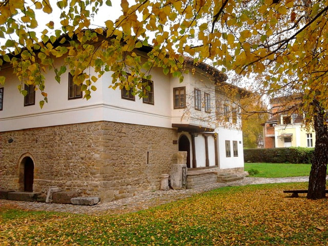
Arandjelovac

The park of Bukovička Banja Spa in Aranđelovac. Author: Slavica Maris
Aranđelovac (Serbian Cyrillic: Аранђеловац), is a town and a municipality located in the Šumadija District of central Serbia. As of 2011, the municipality has a population of 46,225 inhabitants, while the town has 24,797 inhabitants.
It is situated beneath the mountains Bukulja and Venčac, at about 255 metres above sea level, 75 kilometres away from Belgrade. The municipality encompasses two towns and 18 village communities. Also, "Bukovička Banja" Spa is located in the town. Read more.... Aranđelovac - Wikipedia *Soon we will have new photos
|
The distance from Belgrade is about 71,7 km. Approximate time 1h:7m by car.
These instructions are for intended purposes only. You may find that conditions differ from the map results due to construction, traffic, old conditions or other events, so you should plan your route accordingly. You must obey any signs or warnings that concern your route. How to get there ?
Places to visit in ArandzelovacClick on any point of interest for directions on how to get there.

Use Omio for bus or train tickets
|
Čačak
Narodni muzej Čačak - Author: Fortunato32
Čačak (Serbian Cyrillic: Чачак, pronounced [tʃǎːtʃak]) is a cityand the administrative center of the Moravica District in central Serbia. It is located in the West Morava Valley within the geographical region of Šumadija. As of the 2022 census, the city within administrative borders has a population of 105,612 inhabitants.
The city lies about 144 km south of the Serbian capital, Belgrade. It is also located near the Ovčar-Kablar Gorge("Serbian Mount Athos"), with over 30 monasteries built in the gorge since the 14th century. Čačak is located in the western part of central Serbia, within the region of Šumadija. Once densely forested, the region is today characterized by its rolling hills and its fruit trees. To the south, past the Ovčar-Kablar Gorge, lie the mountains of the Dinaric Alps. These mountains incline in a gentle and wavy way toward the Čačak valley and the West MoravaRiver Read more ….. Čačak - Wikipedia *Soon we will have new photos
|
The distance from Belgrade is about 151 km. Approximate time 1h:40m by car.
These instructions are for intended purposes only. You may find that conditions differ from the map results due to construction, traffic, old conditions or other events, so you should plan your route accordingly. You must obey any signs or warnings that concern your route. How to get there?
Places to visit in Čačak |
Zlatibor

Zlatibor-vazdušna banja, Author: Ванилица
Zlatibor (Serbian Cyrillic: Златибор) is a town located at the namesake mountain in the municipality of Čajetina, western Serbia. As of 2011, the population of the town is 2,821 inhabitants
It is a popular tourist resort in Serbia. By road and rail it is connected with Užice and Nova Varoš. It lies on the road linking Belgrade with the Montenegrin coast and off the Belgrade-Bar railway. The town's original name was Kulaševac. In August 1893, King Aleksandar Obrenović came to Kulaševac (Serbian Cyrillic: Кулашевац), and built a fountain called Kraljeva česma (Краљева чесма, "The King's Fountain"). In honor of King Aleksandar's contribution, Kulaševac was renamed to Kraljeva Voda (Краљева Вода, "The King's Water"). In 1903, King Petar Karađorđević I built a villa on the site, helping strengthen the growing trend of turning the slopes surrounding Kraljeva Voda into a vacation spot. After World War II, Kraljeva Voda was renamed to Partizanske Vode (Партизанске Воде, "The Partisans' Waters") in 1946. The name change was out of respect for wounded Zlatibor Partisanswho were murdered by Nazi Germany's army in November and December 1941, while they were recovering in the main hospital of Palisad in the northern part of Kraljeva Voda. In 1995, Partizanske Vode was renamed to Zlatibor, recognizing the mountain upon which the town rests. The town lies roughly 10 kilometers from Tornik, a mountain summit popular with skiing enthusiasts. A gondola lift which spans over 9 km (5.6 mi) and connects the town center of Zlatibor with Tornik ski resort was opened in December 2020. Read more….. Zlatibor - Wikipedia *Soon we will have new photos
|
The distance from Belgrade is about 225 km. Approximate time 2h:40m by car.
These instructions are for intended purposes only. You may find that conditions differ from the map results due to construction, traffic, old conditions or other events, so you should plan your route accordingly. You must obey any signs or warnings that concern your route. How to get there ?
Places to visit in ZlatiborClick on any point of interest for directions on how to get there.

Use Omio for bus or train tickets
|
Krusevac

Trg kosovskih junaka, Author Sonjabgd
Kruševac (Serbian Cyrillic: Крушевац, pronounced [krûʃeʋats] is a city and the administrative center of the Rasina District in central Serbia. It is located in the valley of West Morava, on Rasina river. According to the 2011 census, the city administrative area has a population of 136,752 while the urban area has 81,316 inhabitants. The city was founded in 1371, by Prince Lazar of Serbia (1371–1389), who used it as his seat. Kruševac was founded in 1371, as a fortified town in the possession of Lord Lazar Hrebeljanović. The Lazarica Church (or Church of St, Stephen) was built by Lazar between 1375–78, in the Morava architectural style. It is mentioned in one of Lazar's edicts in 1387, as his seat, when he affirmed the rights of Venetian merchants on Serbian territory. In preparation for the Battle of Kosovo (1389) against the Ottoman Empire, the Serbian army assembled in the city. The site of Lazar's palace is marked by a ruined enclosure containing a fragment of the tower of his spouse Princess Milica, and, according to legend, tidings of the defeat were brought to her by crows from the battlefield. After the battle, the city was held by Princess Milica as her seat. The little that remains of Lazar's city is the Kruševac Fortress, which was declared a Cultural Monument of Exceptional Importance in 1979. Several old Ottoman houses were left at the beginning of the 20th century, besides an old Turkish fountain and bath, which was known as Alacahisar (Aladža Hisar) during Ottoman rule between 1427–1833 (nominally to 1867) when Kruševac was the seat of the Sanjak of Kruševac. The Ottoman rule was interrupted during Austrian occupations between 1688–1690 and 1717–1739.
Read more….. Krusevac - Wikipedia *Soon we will have new photos
|
The distance from Belgrade is about 193 km. Approximate time 2h:15m by car.
These instructions are for intended purposes only. You may find that conditions differ from the map results due to construction, traffic, old conditions or other events, so you should plan your route accordingly. You must obey any signs or warnings that concern your route. How to get there ?
Places to visit in KrusevacClick on any point of interest for directions on how to get there.
|
Kraljevo

Kraljevo, muzeum, Author: Aktron / Wikimedia Commons
Kraljevo (Serbian Cyrillic: Краљево) , is a city and the administrative center of the Raška District in central Serbia. It is situated on the confluence of West Morava and Ibar, in the geographical region of Šumadija, between the mountains of Kotlenik in the north, and Stolovi in the south. In 2011 the city urban area has a population of 68,749 inhabitants, while the city administrative area has 125,488 inhabitants. With an area of 1530 km², it is the largest municipality (after Belgrade) in Serbia by area.The "lower" Ibar region is thought to be the first area where Serbs began to develop cultural, political and economic life. Since the end of the 11th century, the center of Grand Principality of Serbia was in the region of Raška, with state capital in the ancient fortress of Ras, near modern Novi Pazar. There are numerous monasteries in the Kraljevo area, Studenica (1188), Gradac and Stara Pavlica. There is also a medieval fortress known as Maglič. Monastery of Žiča(1219) was the original seat of Serbian Archbishop was used for the crowning of Serbian kings. The village of Rudo Polje, from which Kraljevo arose, was settled during the 14th century. This area was occupied by the Turks between 1458 and 1459. During the Turkish rule Rudo Polje became known as Karanovac. Karanovac became an important settlement during the war between Austria and Turkey in the period between 1718 and 1739. After 1718, a border between Austria and Turkey was established along right bank of river Morava. During the first uprising of the Serbs in 1805, Karanovac was heavily damaged and most of the Muslim population left, leaving the Serbs to continue development of the city during the period following the uprising.
Read more….. Kraljevo - Wikipedia *Soon we will have new photos
|
The distance from Belgrade is about 178 km. Approximate time 2h:19m by car.
These instructions are for intended purposes only. You may find that conditions differ from the map results due to construction, traffic, old conditions or other events, so you should plan your route accordingly. You must obey any signs or warnings that concern your route. How to get there?
Places to visit in KraljevoClick on any point of interest for directions on how to get there.

Use Omio for bus or train tickets
|
Nis

Niš is the third largest city in Serbia and the administrative center of the Nišava District. It is located in southern part of Serbia. According to the 2011 census, the city proper has a population of 183,164, while its administrative area (City of Niš) has a population of 260,237 inhabitants.
Several Roman emperors were born in Niš or used it as a residence: Constantine the Great, the first Christian emperor and the founder of Constantinople, Constantius III, Constans, Vetranio, Julian, Valentinian I, Valens; and Justin I. Emperor Claudius Gothicus decisively defeated the Goths at the Battle of Naissus (present-day Niš). Later playing a prominent role in the history of the Byzantine Empire, the city's past would earn it the nickname Imperial City. After about 400 years of Ottoman rule, the city was liberated in 1878 and became part of the Principality of Serbia, though not without great bloodshed—remnants of which can be found throughout the city. Today, Niš is one of the most important economic centers in Serbia, especially in the electronics, mechanical engineering, textile, and tobacco industries. Constantine the Great Airport is Niš's international airport. The city is also the seat of the University of Niš, the Eparchy of Niš and the Command of Serbian Army. In 2013, the city was host to the celebration of 1700 years of Constantine's Edict of Milan. Read more.... Nis - Wikipedia *Soon we will have new photos
|
The distance from Belgrade is about 237 km. Approximate time 2h:28m by car.
These instructions are for intended purposes only. You may find that conditions differ from the map results due to construction, traffic, old conditions or other events, so you should plan your route accordingly. You must obey any signs or warnings that concern your route. How to get there ?
Places to visit in NisClick on any point of interest for directions on how to get there.
|


Important Notice: The Information for each destination is from Wikipedia


