Uvac River
By Sasapokimica – Own work, CC BY-SA 4.0
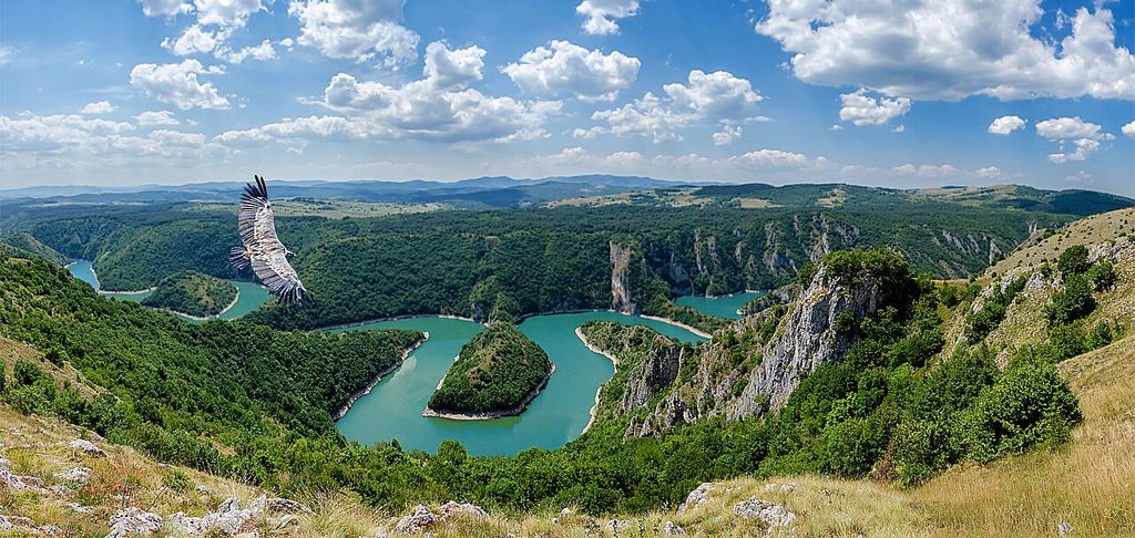
The Uvac (Serbian Cyrillic: Увац) is an international trans-boundary river, rising under Golija mountain and Pešter plateau, then flowing through southwestern Serbia and cross into eastern Bosnia and Herzegovina where, after 115 km, it finally meets the Lim river from the right, however, before it empties into the Lim, for a 10 kilometers Uvac forms the border between two countries. Also, while meandering through Serbia, Uvac loosely makes the northern border of the Raška region, too. The Uvac originates at the Pešter plateau from the Ozren and Ninaja mountains, as Rasanska reka (Cyrillic: Расанска река). The stream curves around the Ninaja and Pometenik mountains, next to the villages of Tuzinje, Rasno, Dragojloviće and Gradac, where it meets Brnjička reka (Cyrillic: Брњичка река), enters the Sjenicadepression and continues on the western border of the plain while receiving the right tributary Vapa (Cyrillic: Вапа) in the northern end. Vapa is 25 kilometers long and drains an area of 496 km2. It passes next to the villages of Gornja Vapa, Donja Vapa, Čedovo and Krstac, where it empties from the right into the shorter river Uvac.
Read more….
Uvac River – Wikipedia
The distance from Belgrade is about 272 klm. Approximate time 4h:18m by car.
These instructions are for intended purposes only. You may find that conditions differ from the map results due to construction, traffic, old conditions or other events, so you should plan your route accordingly. You must obey any signs or warnings that concern your route.
How to get there
Zlatar Lake
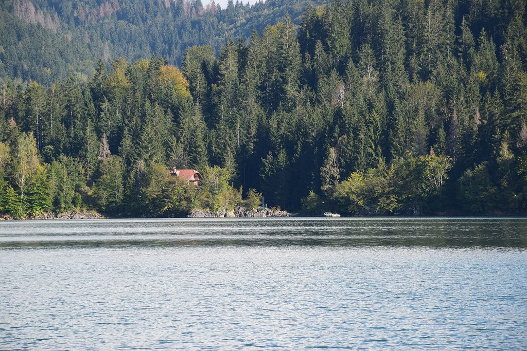
Zlatar Lake (Serbian: Златарско језеро / Zlatarsko jezero) is an artificial lake located among the mountains of Zlatibor and Zlatar (mountain) 15 km from the town of Nova Varoš. The lake was created in the 1960s after the construction of a damon the Uvac river, and covers an area of 7.25 square kilometers and reaches a maximum depth of 75 meters. The region has a continental-Mediterranean climate and is an attractive destination for holidays and recreation; Water-sports. The lake is suitable for treatment of cardiovascular diseases. The lake rests 880 meters above sea level.
The distance from Belgrade is about 259 km. Approximate time 3h:17m by car.
These instructions are for intended purposes only. You may find that conditions differ from the map results due to construction, traffic, old conditions or other events, so you should plan your route accordingly. You must obey any signs or warnings that concern your route.
How to get there.
Kaluderski Skokovi
By Mixapirgossi – Own work, CC BY-SA 4.0
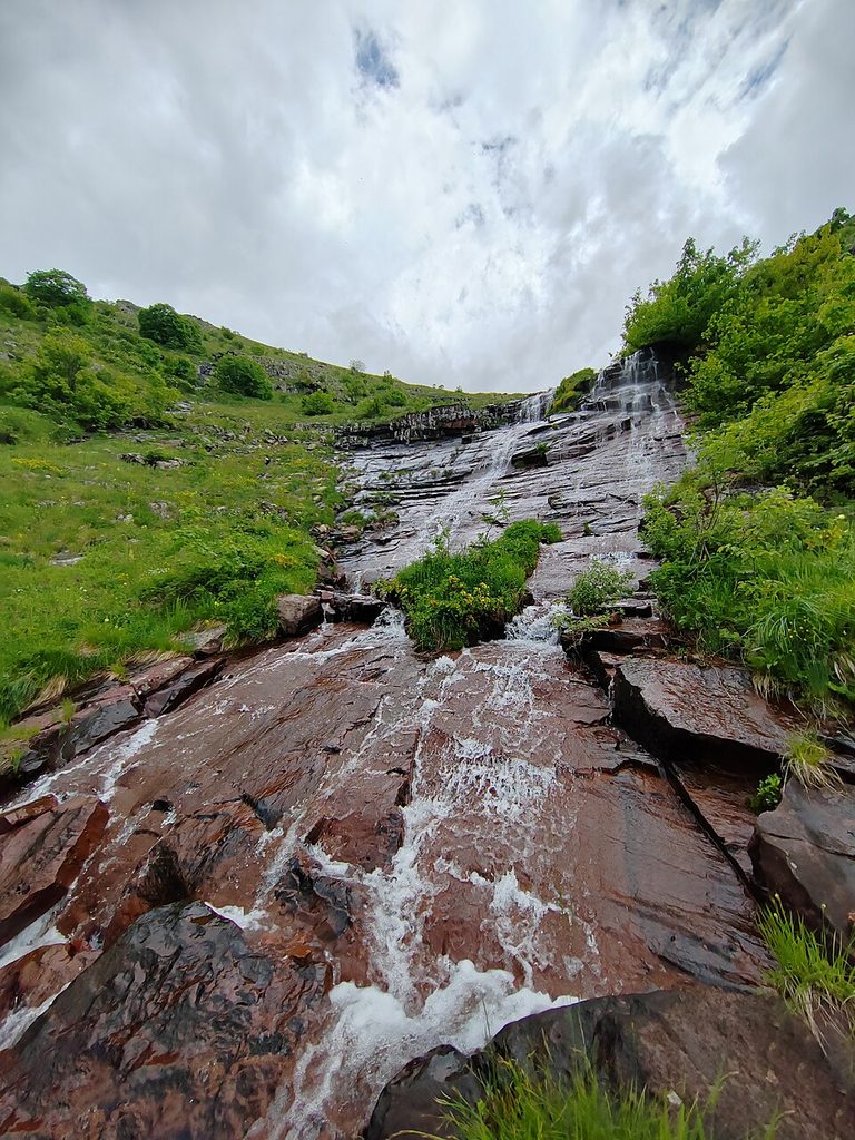
Kaluđerski Skokovi (Serbian: Калуђерски Скокови) is the highest waterfall in Serbia. It is located on the Stara Planina mountain in southeast Serbia. Only discovered in 2012, it is 232 m (761 ft) high, which is over twice more than the Kopren Waterfall, previously the highest waterfall in Serbia, which itself was discovered only a year earlier.
The Kaluđerski Skokovi falls are situated in the area of the Topli Do village, northeast of the city of Pirot, to which it administratively belongs. The waterfall is located just southwest of the Midžor peak on the Stara Planina mountain, close to the border with Bulgaria.
Read more….
Kaluđerski Skokovi – Wikipedia
The distance from Belgrade is about 322 klm. Approximate time 4h:8m by car.
These instructions are for intended purposes only. You may find that conditions differ from the map results due to construction, traffic, old conditions or other events, so you should plan your route accordingly. You must obey any signs or warnings that concern your route.
Kopren Waterfall
By Mixapirgossi – Own work, CC BY-SA 4.0
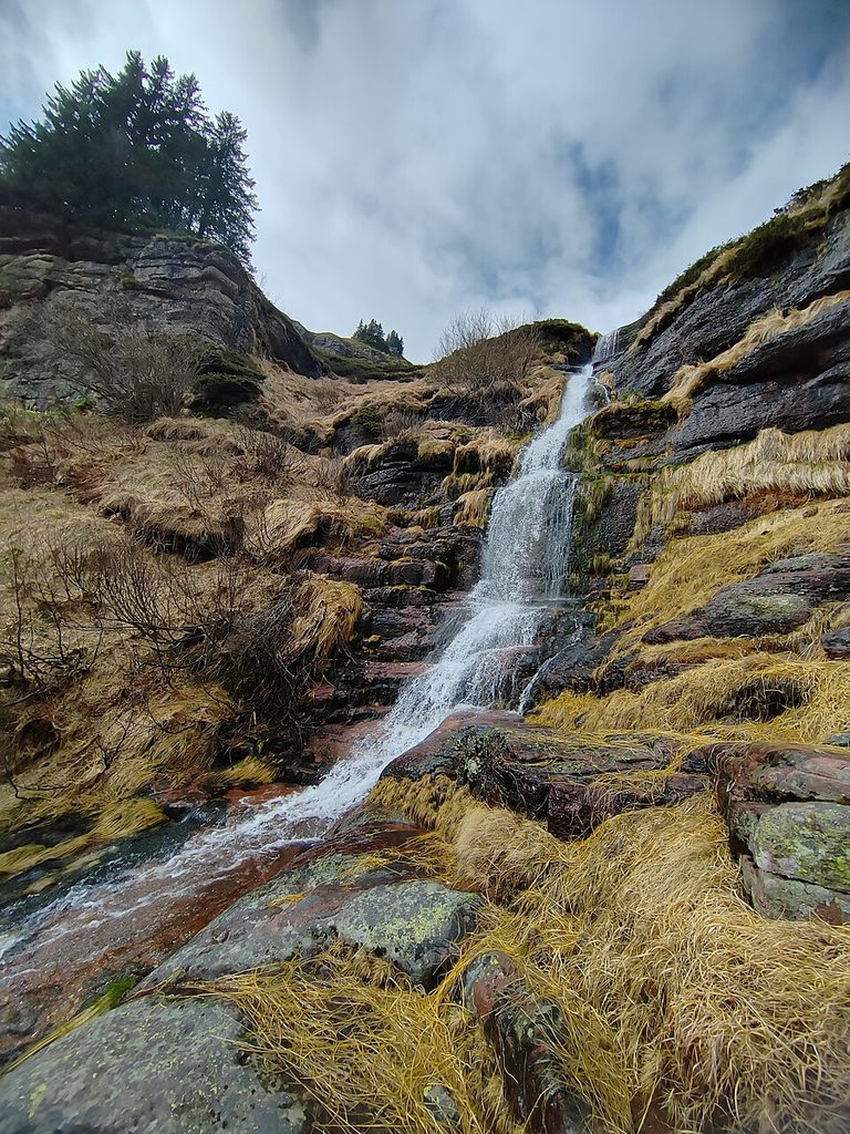
Kopren Waterfall (Serbian: Копренски водопад, romanized: Koprenski vodopad) is the second highest waterfall in Serbia. It is located on Stara Planina mountain in southeast Serbia and 103.5 m (340 ft) high. Between 16 June 2011, when it was measured, and 9 June 2012, when the waterfall Kaluđerski Skokovi was measured, Kopren was considered the highest waterfall in Serbia.
The Kopren waterfall is situated in the area of the Dojkinci village, northeast of the city of Pirot, to which it administratively belong. The waterfall is located under the Kopren peak of the Stara Planina mountain. The peak is 1,963 m (6,440 ft) high, while the waterfall is at an altitude of 1,820 m (5,970 ft).
Read more…..
Kopren Waterfall – Wikipedia
The distance from Belgrade is about 345 klm. Approximate time 4h:13m by car.
These instructions are for intended purposes only. You may find that conditions differ from the map results due to construction, traffic, old conditions or other events, so you should plan your route accordingly. You must obey any signs or warnings that concern your route.
How to get there
Lisine (Veliki Buk)
By Miss83 – Own work, CC BY-SA 4.0
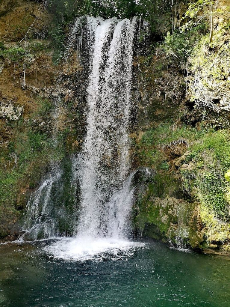
Lisine or Veliki Buk waterfall (Лисине or Велики Бук); located on the Resava River in the east Serbia. It is carved in the karstarea, where the sinking river of the Resava springs again from the ground in the canyon-type valley of Sklop. With the height of 25 meters, it was considered the highest waterfall in Serbia until the 1990s when three higher ones were discovered in the Visok region.
Read more …..
Lisine or Veliki Buk waterfall – Wikipedia
The distance from Belgrade is about 156 klm. Approximate time 2h:11m by car.
These instructions are for intended purposes only. You may find that conditions differ from the map results due to construction, traffic, old conditions or other events, so you should plan your route accordingly. You must obey any signs or warnings that concern your route.
Gostilje Waterfalls
By Andrejnihil – Own work, CC BY-SA 4.0
In the village of Gostilje, in the immediate vicinity of Zlatibor, there is the Gostiljski waterfall, which is one of the highest waterfalls in Serbia. Its height is estimated at around 20 m. The surroundings are rich in beech and pine forests and medicinal plants. As a special feature of this region, the waterfall is one of the most visited tourist destinations.
On the hilly eastern side of Zlatibor, in the direction of the old Užice-Kokin Brod road, is the village of Gostilje. The river Katušnica flows through it, and the hills around it rise: Zaboja, Borkovac and Radenov Omar. It is located at an altitude of 1,000 meters, and it is 25 km from the center of Zlatibor. Gostilje can be reached from several directions. You can get from Zlatibor via Rudin and via Tić-polje. From the direction of Užice, it can be reached via Bela Zemlja and Sirogojn.
Read more…
Gostilje Waterfalls – Wikipedia (RS)
The article is in the Serbian language
The distance from Belgrade is about 230 km. Approximate time 3h:9m by car.
These instructions are for intended purposes only. You may find that conditions differ from the map results due to construction, traffic, old conditions or other events, so you should plan your route accordingly. You must obey any signs or warnings that concern your route.
How to get there